|
The Birth of Charminster
Charminster has never had an official boundary and
its location varies according to who you talk to. It is generally
accepted that the shopping and restaurant area south of the Richmond
Arms is Upper Charminster, while the rest that spreads down the
hill and northwards is Lower Charminster.
Neither really represents the original settlement.
Before 1800, it was an unnamed tract of land between
Moordown and Littledown and began as a tiny huddle of cottages
near the junction of what is now East Way and Charminster Road.
It is believed to have got its name because one of the original
inhabitants came from Charminster near Dorchester.
The first detailed census in 1841 shows just three
families living there - those of Fletcher the tinker, Burridge
the bricklayer and Watton the farm labourer. The population was
in fact bigger than you might think - the Watton family alone
accounted for twelve people.
The heathland provided a living. The villagers grazed
their animals and were self-sufficient in fuel. They cut turf
which was dried and used instead of coal. And they were not short
of sweetening for their food - honey was extracted from from hives
scattered across the heathland
|
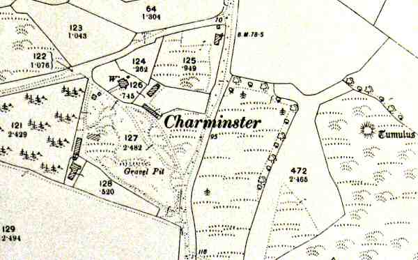
Lower Charminster - still only a settlement of a few cottages
in 1898.
|
Coming to or from the coast, people used a track
that became known as Charminster Lane and subsequently Charminster
Road.
A three acre gravel pit was formed at where West
Way Close is now, and another two acre claypit was formed - its
edge is now part of Fampoux Gardens.
An echo of the ancient past, there were also a number
of tumuli (Bronze Age burial mounds). Most of the prehistoric
sites that littered the heathland here were built over as the
area was developed, and after 2000 years of neglect they would
have been heavily weathered and hard to spot. Many of were only
rediscovered by the Ordnance Survey's 19th Century surveyors.
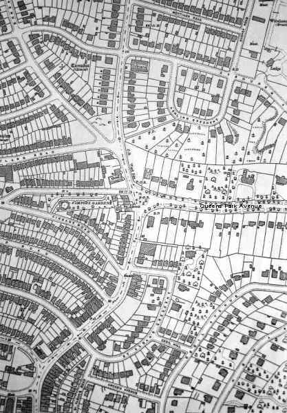
The best local surviving example of the old landscape is to be
found in Queens Park, between the pond and Queens Park Avenue.
If you walk along the footpath when the sun is low in the sky,
you will, with some effort, be able to pick out several low ridges
crossing the golf course. These mark what are believed to be fields
that were abandoned after the Black Death.
The development of the Charminster we know today
started in the 1880s as the Dean Park Estate edged northwards
to end at Lowther Road. That area was previously known as East
Common and its only previous claim to fame was as the site of
Buffalo Bill's Wild West Circus - a spectacle which fired the
imagination of a generation of Bournemouth people.
The development continued to creep northwards through
the 1880's and turn of the century as the Lansdowne Park Estate
was constructed in the parcel of land between Iddesleigh Road
and Alma Road, and the Malmesbury Park Estate was built between
Lowther Road and Richmond Park Road (or Boscombe Farm Road as
it was originally known).
|
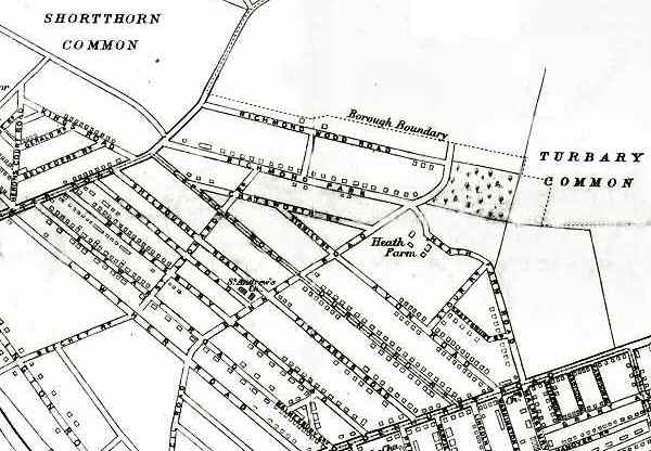
Extent of Upper Charminster development in 1895
|
The Malmesbury Park Estate was in fact split into
several smaller areas - the Devonshire and Rush Corner Estates
were two of them.
As the 19th Century drew to a close, development
in the area was consolidated, rather than expanded, with houses
being built on plots that had already been laid out.
There were however two new areas opened up for development.
Claypit Common (now Hankinson Road to Green Road) became the South
Winton Estate, and south of this, and significantly for Charminster,
Shortthorn Common (now Alma Road to Maxwell Road) became the Charminster
Park Estate. There was even a central 'Charminster Park' which
was built around an exhausted claypit and brickfield. That park
became Winton Recreation Ground. These areas had been more or
less claimed as being part of Winton, by being included in the
Winton Urban District Council's boundary.
The first 25 years of the last century saw the development
of the Richmond Park Estate between Richmond Park Road and Queens
Park Avenue. Its name lives on with the Richmond Park Bowling
Club based at Winton Rec.
|
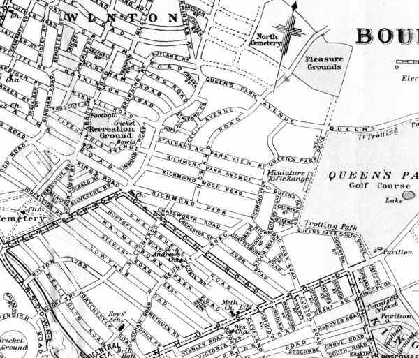
Developments by 1923
|
Other developments in the first thirty years of
the last century included the Charminster Estate around Charminster
Avenue and the Charminster Hill Estate which included Bushey Road.
|
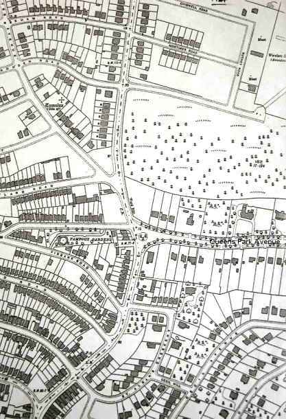
Lower Charminster - 1924
|
|
Lower Charminster - 1933
|
The 1920s saw a consolidation of housing stock,
with much infill development around Charminster. There were also
several important public buildings which were sited on the Charminster
Hill ridge, including Saint Francis of Assisi church, where various
birds and animals are incorporated into the design, Saint Walburga's
School, and Charminster Library, which was known by that name
from 1939. East Way was begun, and an infant and junior school
were built along its south side - known for a time as the Charminster
Road School.
When Bournemouth Council built the early council
houses in Luckham Road, the estate was named 'Lower Charminster'
even though there had never been an 'Upper Charminster'. From
that decision came the concepts on an "upper" and "lower"
Charminster.
|